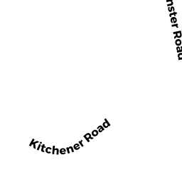
10 KITCHENER ROAD
Owner Information
MALONEY, WILLIAM A
10 KITCHENER ROAD
STERLING, MA 01564


Property Details
10 KITCHENER ROAD is classified as a Single Family Residential (Raised ranch).
The primary structure on this property was built in 1977. There are 4,246ft2 of built area within this property. There is 1,956ft2 of residential/living space within this property. This property is listed as having 9 rooms.
10 KITCHENER ROAD is valued at $379,100. The land is valued at $131,700 and the structures are valued at $245,000. There is an additional valuation of $2,400 on this property.
This property is in Zone RRF. Confirm with local Zoning Board authorities to ensure there are no overlays or other easements on this property.
The most recent deed for 10 KITCHENER ROAD is recorded at the local registrar in Book 47024, Page 0316. 10 KITCHENER ROAD was last sold on Friday, January 28, 2011 for $275,000.
Assessment data from fiscal year 2022.
Flood Data
According to the FEMA National Flood Hazard Layer, this property does not appear to be in a flood zone. It may also be in an area not yet reviewed. Nonetheless, confirm this information prior to taking any action.
To view the flood hazards around this property, create a FEMA "Firmette" Map of the area around 10 KITCHENER ROAD.
Broadband Internet Providers
| Provider | Type | Bandwidth (mbps) | |
|---|---|---|---|
| GCI Communication Corp. | Satellite | 0 | 0 |
| Viasat Inc | Satellite | 100 | 3 |
| Verizon New England Inc. | DSL | 15 | 1 |
| Comcast | Cable | 1000 | 35 |
| T-Mobile | Fixed Wireless | 25 | 3 |
| VSAT Systems, LLC. | Satellite | 2 | 1 |
| HughesNet | Satellite | 25 | 3 |
Broadband service provider data from December 2020.
Adjacent Properties
- 16 EAST PARK ROAD
Single Family Residential owned by HASSETT SCOTT - 9 KITCHENER ROAD
Single Family Residential owned by TREMBLAY JOHN S - 6 KITCHENER ROAD
Single Family Residential owned by DELEON FRANCISCO - 5 EVERGREEN CIRCLE
Single Family Residential owned by LANDO ERIC - TUTTLE ROAD (OFF)
Vacant, Conservation (Municipal or County) owned by STERLING TOWN OF